27 BROOKSIDE DR
Owner Information
PAJAK, THOMAS
27 BROOKSIDE DR
WEST SPRINGFIELD, MA 01089


Property Details
27 BROOKSIDE DR is classified as a Single Family Residential (Raised ranch).
The primary structure on this property was built in 1964. There are 3,236ft2 of built area within this property. There is 1,500ft2 of residential/living space within this property.
27 BROOKSIDE DR is valued at $282,700. The land is valued at $117,500 and the structures are valued at $161,500. There is an additional valuation of $3,700 on this property.
This property is in Zone RA-1. Confirm with local Zoning Board authorities to ensure there are no overlays or other easements on this property.
The most recent deed for 27 BROOKSIDE DR is recorded at the local registrar in Book 22689, Page 0567. 27 BROOKSIDE DR was last sold on Friday, May 31, 2019 for $280,000.
Assessment data from fiscal year 2022.
Flood Data
According to the FEMA National Flood Hazard Layer, this property does not appear to be in a flood zone. It may also be in an area not yet reviewed. Nonetheless, confirm this information prior to taking any action.
To view the flood hazards around this property, create a FEMA "Firmette" Map of the area around 27 BROOKSIDE DR.
Broadband Internet Providers
| Provider | Type | Bandwidth (mbps) | |
|---|---|---|---|
| T-Mobile | Fixed Wireless | 25 | 3 |
| GCI Communication Corp. | Satellite | 0 | 0 |
| Viasat Inc | Satellite | 100 | 3 |
| VSAT Systems, LLC. | Satellite | 2 | 1 |
| HughesNet | Satellite | 25 | 3 |
| Verizon New England Inc. | DSL | 5 | 0 |
| Comcast | Cable | 1000 | 35 |
Broadband service provider data from December 2020.
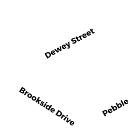
Adjacent Properties
- 564 DEWEY ST
Single Family Residential owned by FARRELL, WILLIAM J - 54 PEBBLE PATH LN
Single Family Residential owned by REAY, JAMES E - 550 DEWEY ST
Single Family Residential owned by UTTECHT, MARK A & THERESA A - 542 DEWEY ST
Single Family Residential owned by SCULLY, CHRISTOPHER M - 37 BROOKSIDE DR
Single Family Residential owned by SUSSMAN, DOUGLAS R